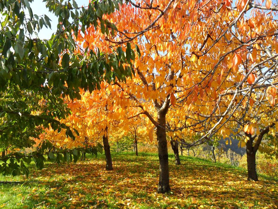
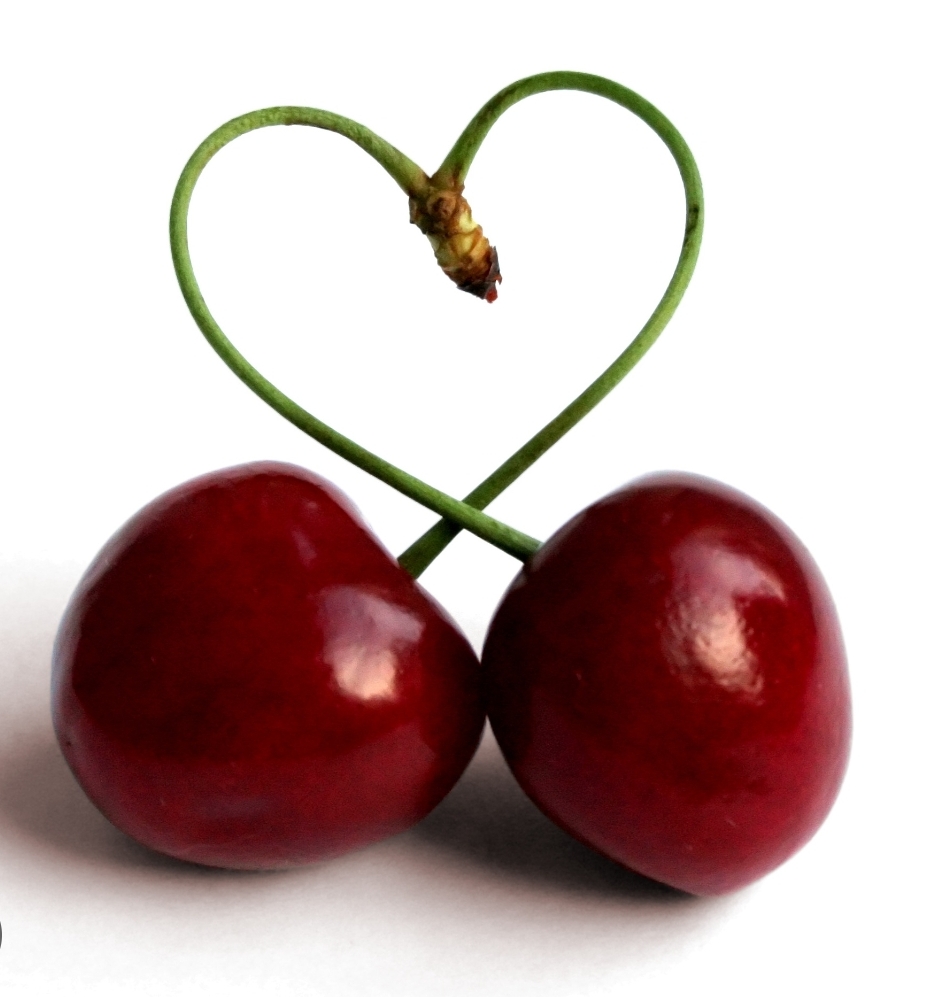
To Visit Route 5: Cherry tree trail
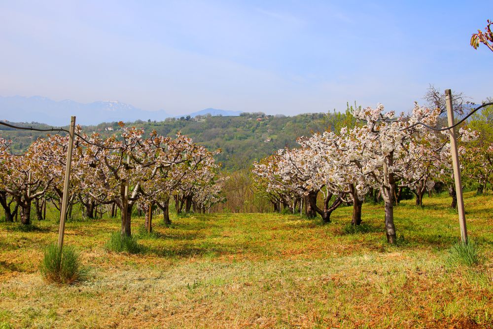


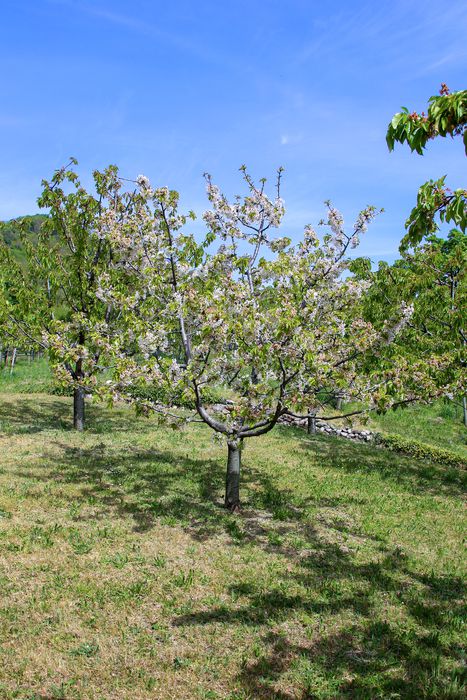
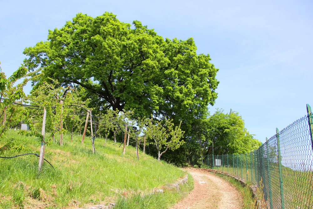
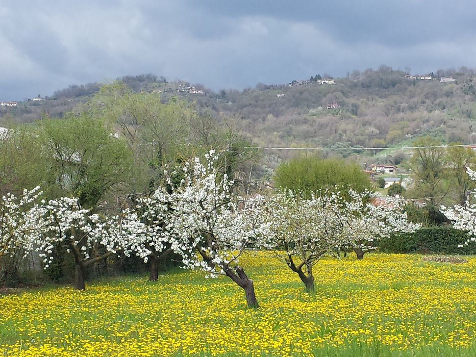
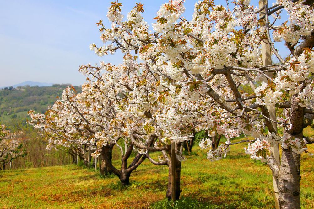
This path, more than others, offers its users a real full immersion in a landscape where cherry trees dominate and, needless to say, whose charm is enhanced in spring at the time of flowering. The entire route is characterized by environmental aspects and panoramic views of the hills and the plain.
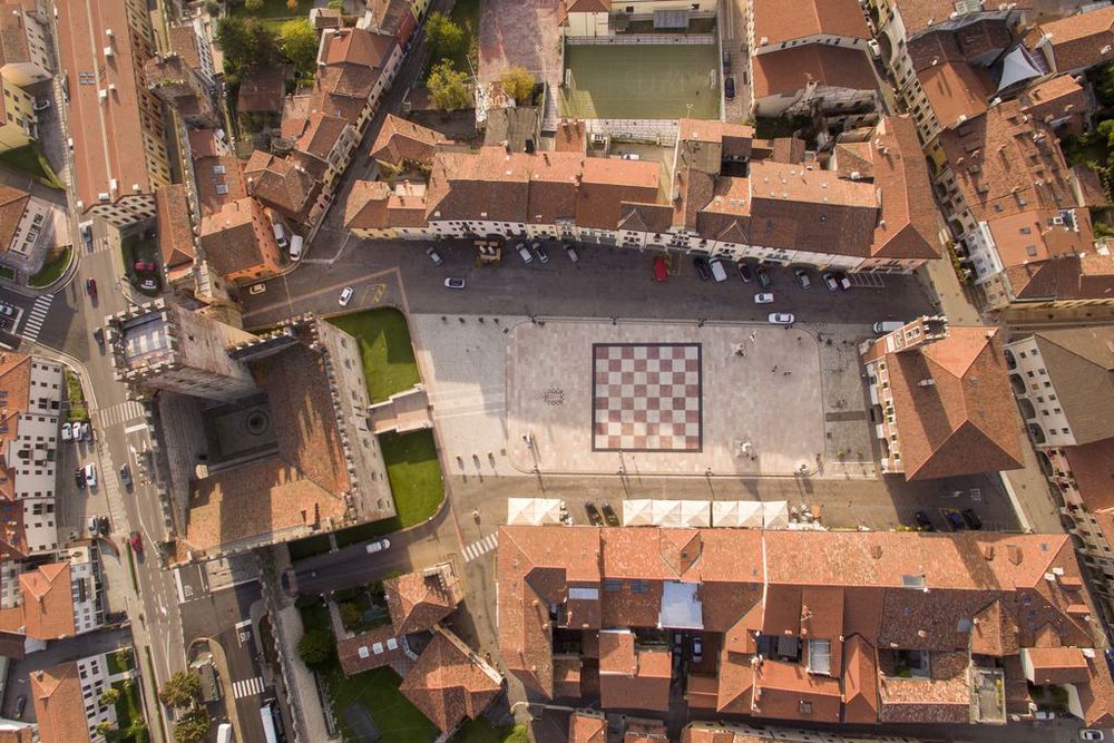
The path from Pianezze leads to Marostica through the hamlet of Roveredo Alto and the hamlet of San Luca, from which it descends into via Panica. Two options from here: a visit to the historical centre of the City of the Chess Board or a path back to Pianezze. The route also includes a short variant (5A) in the territory of Pianezze, which takes about an hour to cover. This path too offers a good occasion to appreciate the landscape in its essence, even if after a short but demanding ascent.
If the user is wishing to take a short but beautiful walk, the main route can be split into two stretches: one section to Oldelle and the second further on until the end of via Creazzo. The walk can continue from these two points straight on towards the centre of the town of Pianezze with ease.
Average duration: 2 h 30 min
Length: 7,51 km
Difference in height: 252 mt
Accessibility: asphalted road - path
Other routes: Val d'Inverno and the chestnut trees of the villages Costa, Marosi and Valeri, Route 1: From the Medieval village to the walled city, Route 2: From ancient convents to a natural jewel: Gorghi Scuri, Route 4: From the walled city to the suggestion of Val d'Inverno,
Variant 5A - Pianezze - località Malossi - Via Sandri
Average duration: 1 h
Length: 2,40 km
Difference in height: 134 mt
Accessibility: asphalted road - path
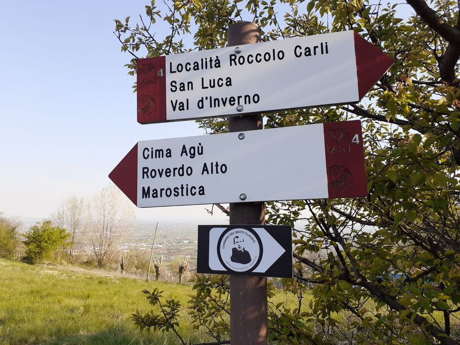
The route starts from the center of Pianezze in via Roma. Take the first part of via Sandri on the left and then turn right into via Moscardina. After a few meters, take the first turn on the left and keep right walking pasta an unpaved path following the signs that lead to Malossi (Warning: this is the point where the cherry tree route "Sentiero dei Ciliegi, n. 5" is found together with other two signed historical paths: one with a white background and the symbol of cherries and the "Colceresa" path). From the northern end of the district of Malossi climb up into the coppice wood. It is not rare to be accompanied by the flowing waters of the stream below. The ascent is interrupted by a resting place where strollers can catch their breath. At this point, there is a route diversion to the left which descends mostly along an asphalted road (the road code applies here), along variant 5A, which runs sided by cherry and chestnut trees for a good stretch.
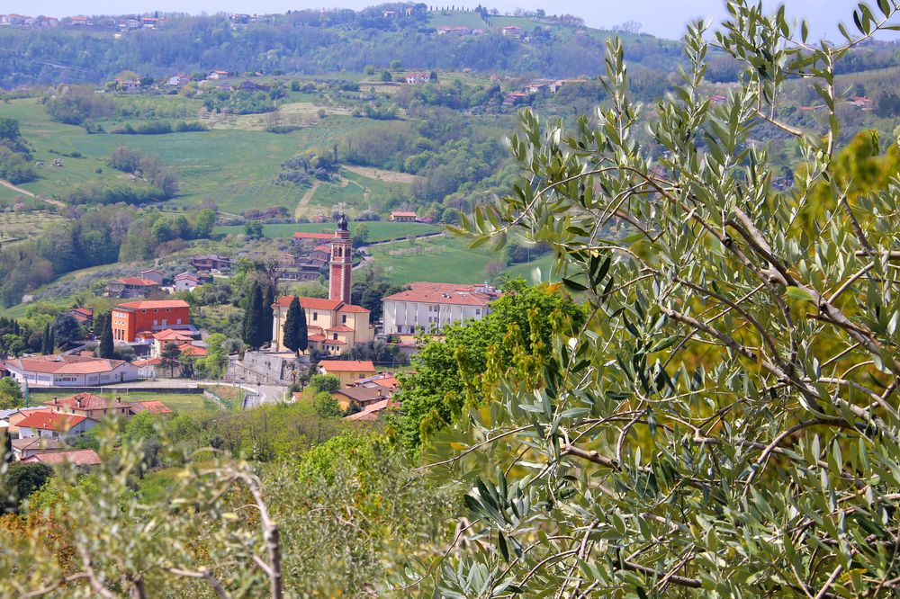
The main itinerary, on the other hand, continues straight on from the lay-by through a characteristic and wide cherry tree plantation until via Sandri, which needs to be followed on the left for a short stretch and then diverts in the middle of the orchards on a narrow path, which ends up on a paved road again. At this point (the road code still applies here), turn left (on via Roccolo Carli) where the signs located about 100 m ahead direct towards the connection with Route n. 4 (unpaved road on the right). This is the road map to be followed from here on for a long stretch. When at the junction between via d'Agù and via Costacurta, keep to the right along the path in the direction of Marostica (the historic military post of the First World War is visible). The descent towards the intermediate village of Roveredo Alto is mostly along a narrow but easy shady path. Once in Roveredo, enter the district passing in front of the Church of Madonna delle Grazie and then head south again. The downhill path has to be walked carefully both because the bowl is slippery and because there are rather steep slopes in some places. This stretch leads to Marostica, via Panica, where a visit can be paid to the historical centre turning left. The walk back to Pianezze starts taking via della Resistenza on the right (a signpost showing number 5 is affixed at this point), followed by a small allotment path that runs along the hillside and leads into via Giovan Battista Ferrari. Climb up to this point along the paved road with due respect for the highway code. The signs invite to continue as far as via Oldelle, that is the street on which tired strollers can continue straight ahead to return to the starting point in Pianezze in a short time. The main route, on the other hand, continues beyond the difference in height at the edge of via Oldelle, taking a short climb from where it unwinds into a winding but pleasant and easy path, along which strollers can one more time enjoy a full immersion in cherry trees and the various view points. The junction is at a resting place. Then turn left to take a small white road. After a short walk the strollers are back on the asphalt road where the usual warning applies. Go down via Creazzo. This stretch of the path is one of the most panoramic sections of the entire route. At the end of via Creazzo two options are available: go right to finish the walk quickly and to return to Pianezze, via Roma; or turn left and follow the signs to the Oratory of San Filippo e Giacomo which is reached going down via Oldelle and turning right to take a path in correspondence of an apparently private entrance limited by two stone and terracotta pillars that is in reality a public road. Walk as far as the end of the first stretch and, at the bed and breakfast, turn right and go down gently, then uphill to the hill where the ancient Oratory of San Filippo e Giacomo stands. Walk on and back on the sidewalk of the road and then turn into via Beltrame and go back to the starting point.
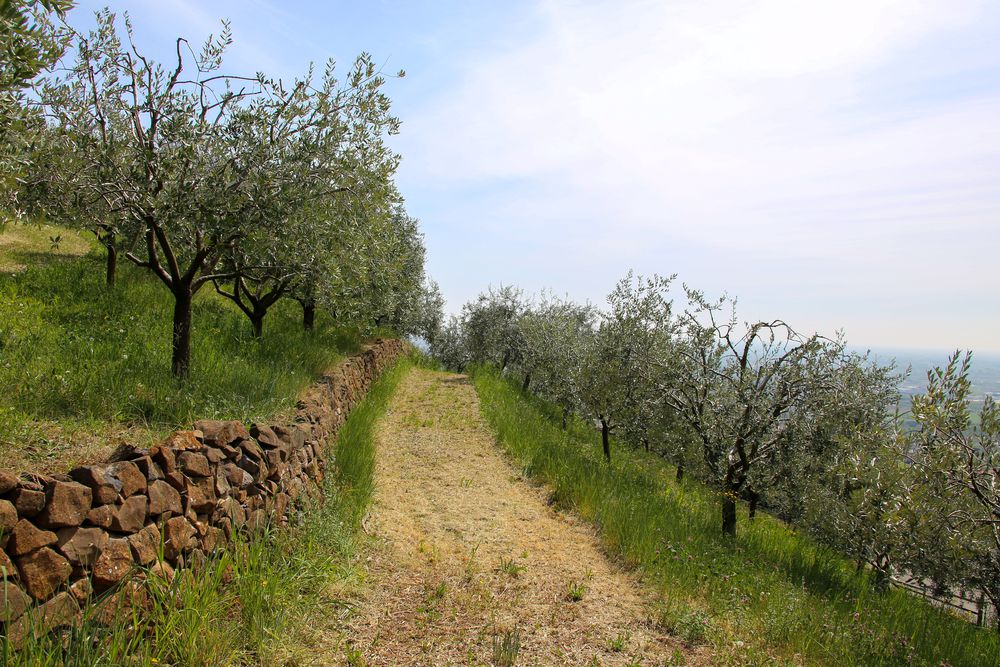
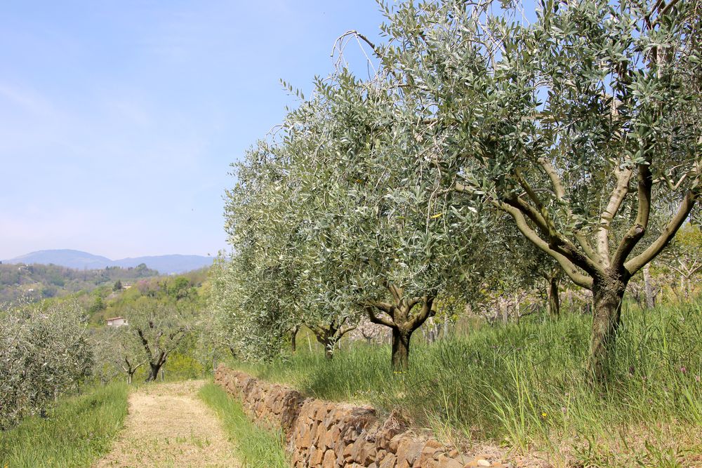
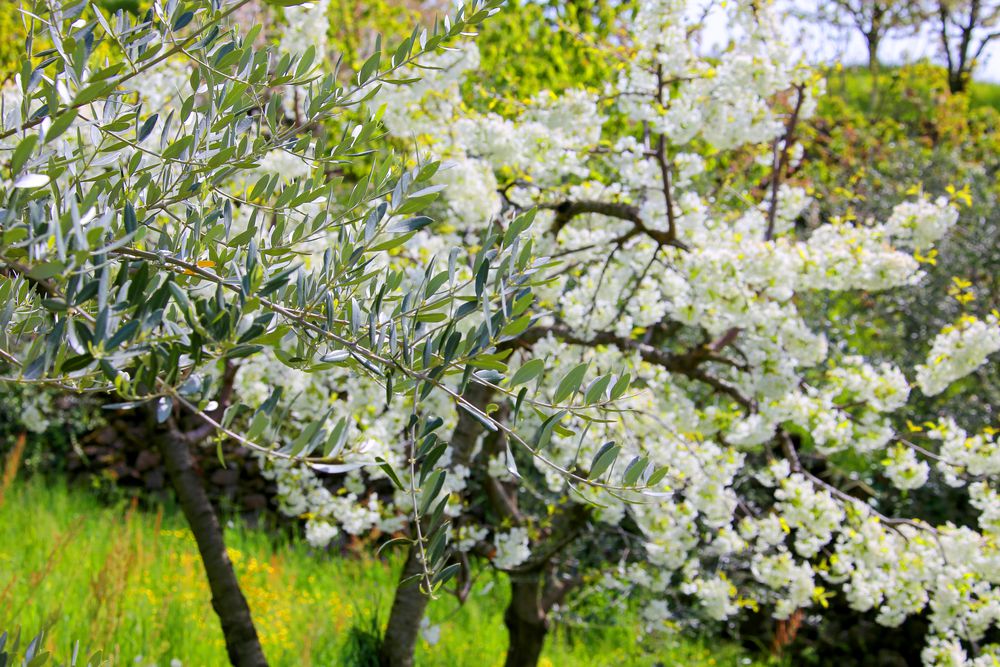
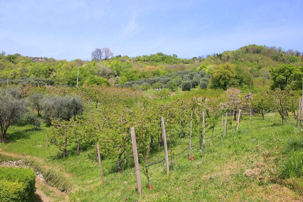
This route offers the opportunity to observe various characteristics of the territory: outcrops of basaltic volcanic rocks, sandstone and limestone and tufa volcanic sedimentary rocks; terraces of sloping ground the locals call masiére, i.e. dry-stone walls, built using local rocks; vallecole engraved and dug by streams. The hydrography of the territory presents a fairly rich variety: rivers, streams, brooks and springs that over time man has channeled and ordered to enhance irrigation, to improve soil conditions and to exploit the potential strength of water. In the area of Oldelle, in the district of Pianezze, rivulets descend from the small valleys into the rosa dea vale (lit. valley irrigation ditch) and then into an unspecified stream, rium. Along the way, you will frequently come across meadows, vegetable gardens, vineyards, olive groves, cherry trees and many other fruit trees, set in a very unique hilly environment that presents several areas of great naturalistic interest. The wooded vegetation is mainly made up of tall trees, such as Robinia's weeds, numerous white hornbeams, the large chestnut trees of which sometimes traces remain in the stumps, the elm trees, ornielli, maple trees, and the so-called spaccasassi (lit. rock breakers), whose roots sink into the rocks and create twists and turns, the great alders, typical of the wetlands, and some at times majestic specimens of oaks, poplars, plane trees, mulberries and willows. There is also a rich undergrowth made up of extensive patches of stingers and brambles, many ferns belonging to various species, carpets of mosses and horsetails, various colored lichens that cover the rocks and the luxuriant ivy that often covers the trunks of the plants. The meadows, mainly cultivated with grass and clover and mowed regularly, give forage that is rich in nutrients.
The quieter areas, far from the inhabited centers, are populated by foxes, badgers, hedgehogs, martens, weasels, dormouse, hares and the roe deer. Strollers are very likely to see squirrels jumping from one branch to another or pairs of pheasants hiding in the tall grass of the meadows. There are also many birds that live and nest in the trees, where the wood is thicker: the blackbird, the thrush, the great tit, the finco, the robin and the crow. The numerous watercourses are the home to live fish such as marsoni, shrimps, squaleti (lit. small sharks), trout and amphibians such as frogs, toads, salamanders and tritons. Blindworms, ande and carbonassi are common reptiles in these areas.
In this route
-
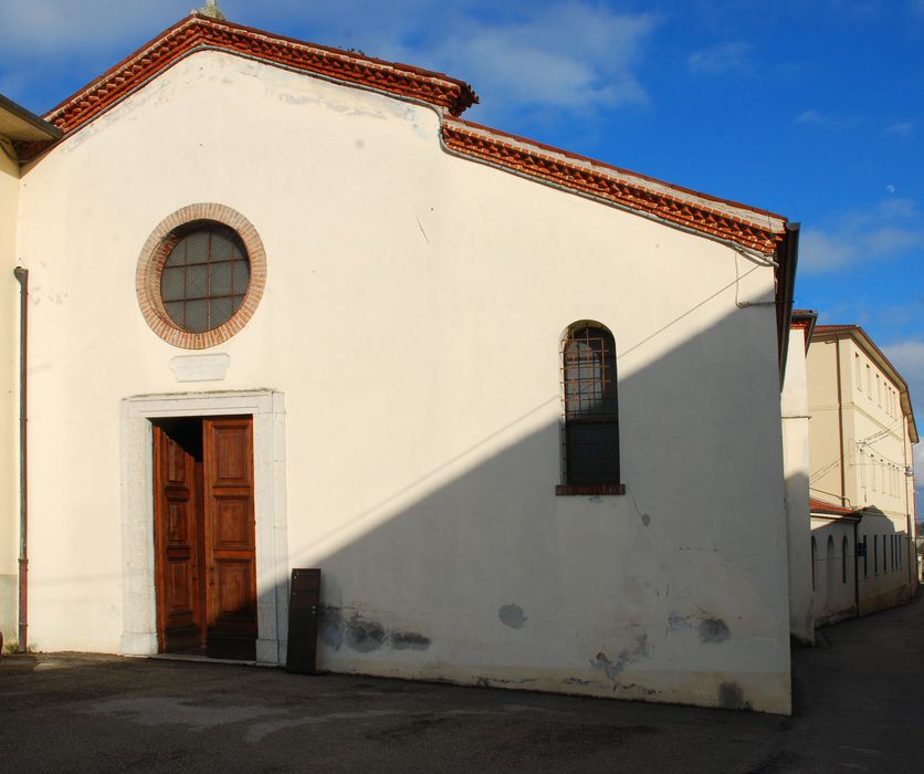
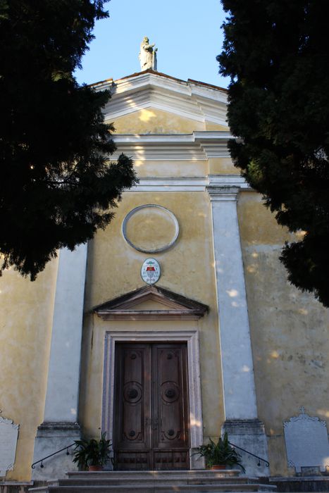
![]() Church of Saint Rocco
Church of Saint Rocco
-
![]() Church of Madonna delle Grazie
Church of Madonna delle Grazie
-
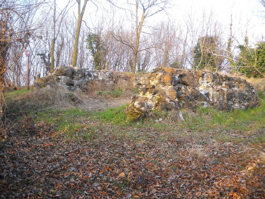
![]() Military post of the first world war
Military post of the first world war
-
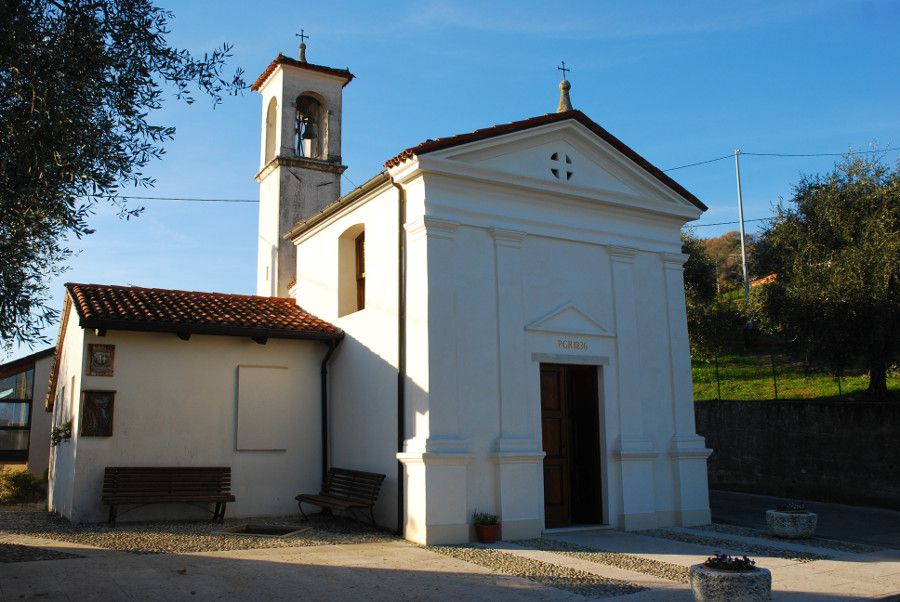
![]() Parish Church of San Lorenzo Martire, Piazza IV Novembre
Parish Church of San Lorenzo Martire, Piazza IV Novembre
-
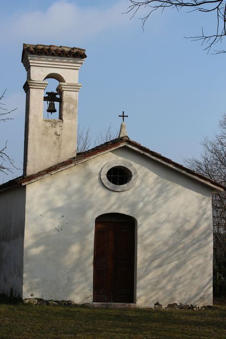
![]() Oratory of San Filippo e Giacomo
Oratory of San Filippo e Giacomo
-
![]() The house of Bernardino Frescura
The house of Bernardino Frescura
Accomodation
-
Hotel Europa
Viale Stazione, 5/A - Marostica
Vedi i dettagli -
Hotel Due Mori
Corso Mazzini, 73/75 - Marostica
Vedi i dettagli -
Villa Cecchin Guesthouse
Via Gianni Cecchin, 69 - Marostica
Vedi i dettagli -
Suite Parolin
Corso Mazzini, 142 - Marostica
Vedi i dettagli -
Campana Suites
Viale Stazione, 32 - Marostica
Vedi i dettagli -
Marostica
Via Camplani, 60 - Marostica
Vedi i dettagli -
A Casa mia
Via Ca' Brusà, 23 - Marostica
Vedi i dettagli -
Da Viky
Via Mantegna, 12 - Marostica
Vedi i dettagli -

Borgo Castello
Via C.Battisti, 15 - Marostica
Vedi i dettagli -
Retrò
Via Ravenne, 36 - Marostica
Vedi i dettagli -
I Mirtilli
Via Gazzo, 33 - Pianezze
Vedi i dettagli -
Il Geranio
Via Oldelle, 4/A - Pianezze
Vedi i dettagli -
Agriturismo Antico Borgo
Via Marosi, 4 - Marostica
Vedi i dettagli -
Agriturismo Al Ciliegio
Via Val Bella Alta, 5 - Marostica
Vedi i dettagli -
Agriturismo Ai Marosi
Via Marosi, 2 - Marostica
Vedi i dettagli -
Antica Corte Carollo
Via A. De Gasperi, 2 - Pianezze
Vedi i dettagli -
B&B Maria
Via IV Martiri 21 - Marostica
Vedi i dettagli -
Marostica Bright Apartment
Via Callesello delle Monache 1 -Marostica
Vedi i dettagli -
Agriturismo Dai Sandri
Via Oldelle, 1A - Pianezze
Vedi i dettagli -
Al Mulino
Via Gobbe, 60 - Marostica
Vedi i dettagli -
L'Angelo e il Diavolo
Piazza Castello, 41/A - Marostica
Vedi i dettagli -
Madonnetta
Via Vajenti, 21 - Marostica
Vedi i dettagli -

Lunaelaltro
Corso della Ceramica, 33 - Marostica
Vedi i dettagli -
Panic Jazz Club
Piazza Castello, 42 - Marostica
Vedi i dettagli -
Ristorante cinese Oriente
Via G. Cecchin, 20/b - Marostica
Vedi i dettagli -
Da Bastian
Via Gobbe, 10/a - Marostica
Vedi i dettagli -
Da Roberta
Via Panica, 150 - Marostica
Vedi i dettagli -
Da Rossi
Via Consagrollo, 69 - Marostica
Vedi i dettagli -
Ristorante Pizzeria Bistrot 77
Via Gazzo, 2 - Pianezze
Vedi i dettagli -
Caissa
Corso Mazzini, 104 - Marostica
Vedi i dettagli -
Al Sole
Via Fondati, 3 - Marostica
Vedi i dettagli -
Al ciliegio
Via Val Bella, 5 - Marostica
Vedi i dettagli -
All’Angelo d’Oro
Viale Montegrappa, 20 - Marostica
Vedi i dettagli -
La casetta
Viale Vicenza, 12/A - Marostica
Vedi i dettagli -
Dalla Zita
Via Cà Brusà, 5 - Marostica
Vedi i dettagli -
Ristorante Cuori
Corso Mazzini, 73/75 - Marostica
Vedi i dettagli
To live
Events in the territory
All the events to live
To love
To visit
-
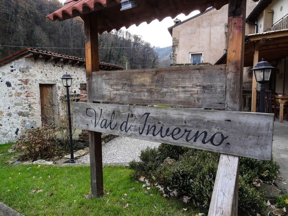
![]() Val d'Inverno and the chestnut trees of the villages Costa, Marosi and Valeri
Val d'Inverno and the chestnut trees of the villages Costa, Marosi and Valeri
The hamlet of Vallonara is the starting point of this route which runs through the shady and suggestive Val d'Inverno. ...
-
![]() Route 1: From the Medieval village to the walled city
Route 1: From the Medieval village to the walled city
This is one of the most popular scenic routes for tourists. Easily practicable, it leads to the upper part of ...
-
![]() Route 2: From ancient convents to a natural jewel: Gorghi Scuri
Route 2: From ancient convents to a natural jewel: Gorghi Scuri
This route leads to one of the most suggestive naturalistic sites to discover in our territory: Gorghi Scuri, waterfalls along ...
-
![]() Route 4: From the walled city to the suggestion of Val d'Inverno
Route 4: From the walled city to the suggestion of Val d'Inverno
IMPORTANT! Please note that trail no. 4 is accessible up to Roccolo Carli, which is currently excluded from the route. ...
-
![]()
...