To Visit On the tracks of the Malgàri
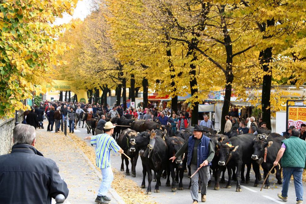
This route runs along the tracks followed by the shepherds of the Po river valley at the time of transhumance, a tradition that dates back to the Middle Ages and which in our days only a few passionate breeders carry on, walking their flocks and herds to the pastures of the Asiago Plateau to spend spring and summer there.
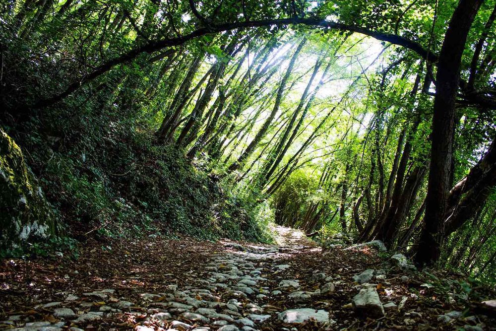
The proposed itinerary is quite long, so visitors can decide whether to cover it all or only take the uphill stretch to San Luca or the flat stretch to Nove. The rural landscape visible while going up and down from San Luca is really a gentle slope towards the plain along meadows and orchards. The part of the track in the plain runs along the bank of the Longhella stream and it is open and sunny. Encounters of grey herons are frequent. The route is easy and runs on a wide and comfortable unpaved path; it is very suitable for cycling trips with children.
Average duration: 1 h 45 minutes
Length: Route north: 12.83 km
Difference in height: 331 mt
Accessibility: unpaved and asphalt route along low traffic roads
Other routes: Marostica, a town in the plain: villas, churches and country houses
Variant
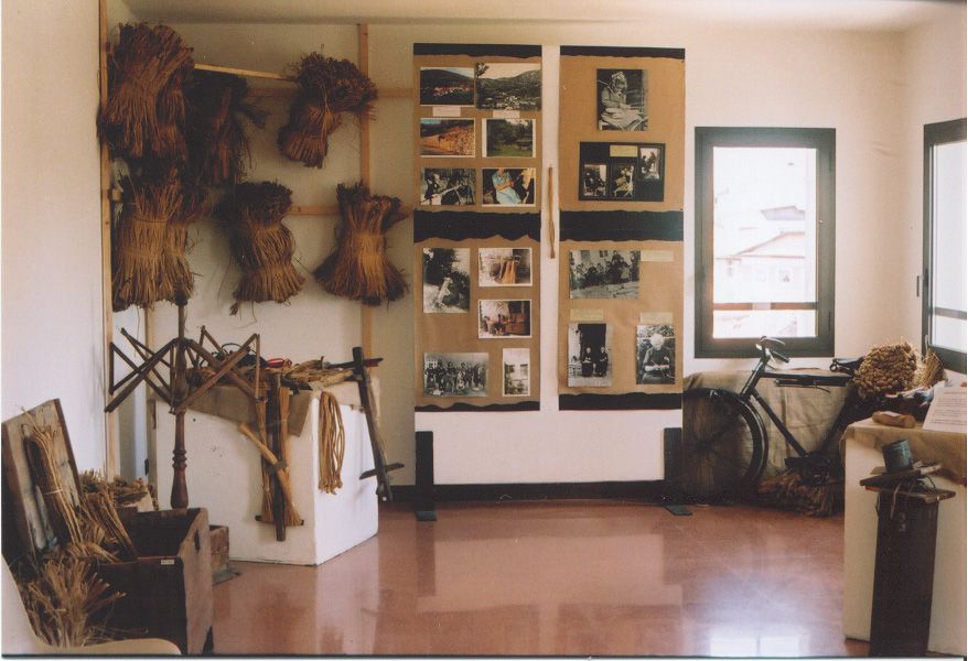
Campo Marzio is the starting point. From here, take via delle Due Rogge in northerly direction, at the end of which cross the provincial road with due care and turn left into via Gianni Cecchin, from which, after a short stretch, turn left onto the cycling lane/pedestrian path to Vallonara running along the bank of the Longhella stream. At the hamlet of Vallonara leave the cycling lane and turn left (be careful!) to access the provincial road. After a short stretch, before the climb, turn left into via Valeri. A building known as Comando Tappa is visible on the right after a short stretch. During the First World War this place was the gateway of the troops leaving for the Asiago Plateau. Keep right taking via Caribollo and then Minuzzi and via Boli heading to Crosara. At the end of the ascent, still walking along a stretch without major steep gradients, yet constant and therefore challenging, access the center of the hamlet and cross the provincial road and then shortly go up to the characteristic square of the former church that has been converted into the "Ecomuseum of straw and peasant tradition", which can be visited on Sundays or prior booking. It is possible to stop for a break in the panoramic garden, just north of the church, which is known as "the balcony over Marostica" for its position. The transhumance trail continues north along the Sentiero del Sejo path, which requires a suitable bike and additional effort.
The return journey starts from the square below the parish church (Piazza San Bortolo): cross the provincial road and take via Adani, the municipal road for San Luca. Then follow the asphalt road downhill, cross the bridge in the lower part of the hamlet of San Luca and then walk back down towards Marostica. After a short distance, turn left onto via Perozzi along a descent that leads to Campo Marzio from another side, through Val d'Inverno. The road runs embedded in the hills and alongside a stream that descends from Val del Costolo forming the Longhella stream further downstream. The stretch is particularly evocative because of a sequence of small waterfalls and limestone rock formations that make up the typical setting of this shady and water-rich area. Both in summer and in winter, nature will certainly be a wonderful show to experience. The village of Vallonara is easy to reach taking the cycling lane back to the starting point.
In this route
Accomodation
-
Hotel Europa
Viale Stazione, 5/A - Marostica
Vedi i dettagli -
Hotel Due Mori
Corso Mazzini, 73/75 - Marostica
Vedi i dettagli -

Beewell Italy
Via Colpi Pivotti, 12 - Marostica
Vedi i dettagli -
Villa Cecchin Guesthouse
Via Gianni Cecchin, 69 - Marostica
Vedi i dettagli -
Suite Parolin
Corso Mazzini, 142 - Marostica
Vedi i dettagli -
Fattoria TogoNegro
Via Caribollo, 81 - Marostica
Vedi i dettagli -
Campana Suites
Viale Stazione, 32 - Marostica
Vedi i dettagli -
Marostica
Via Camplani, 60 - Marostica
Vedi i dettagli -
A Casa mia
Via Ca' Brusà, 23 - Marostica
Vedi i dettagli -
Da Viky
Via Mantegna, 12 - Marostica
Vedi i dettagli -
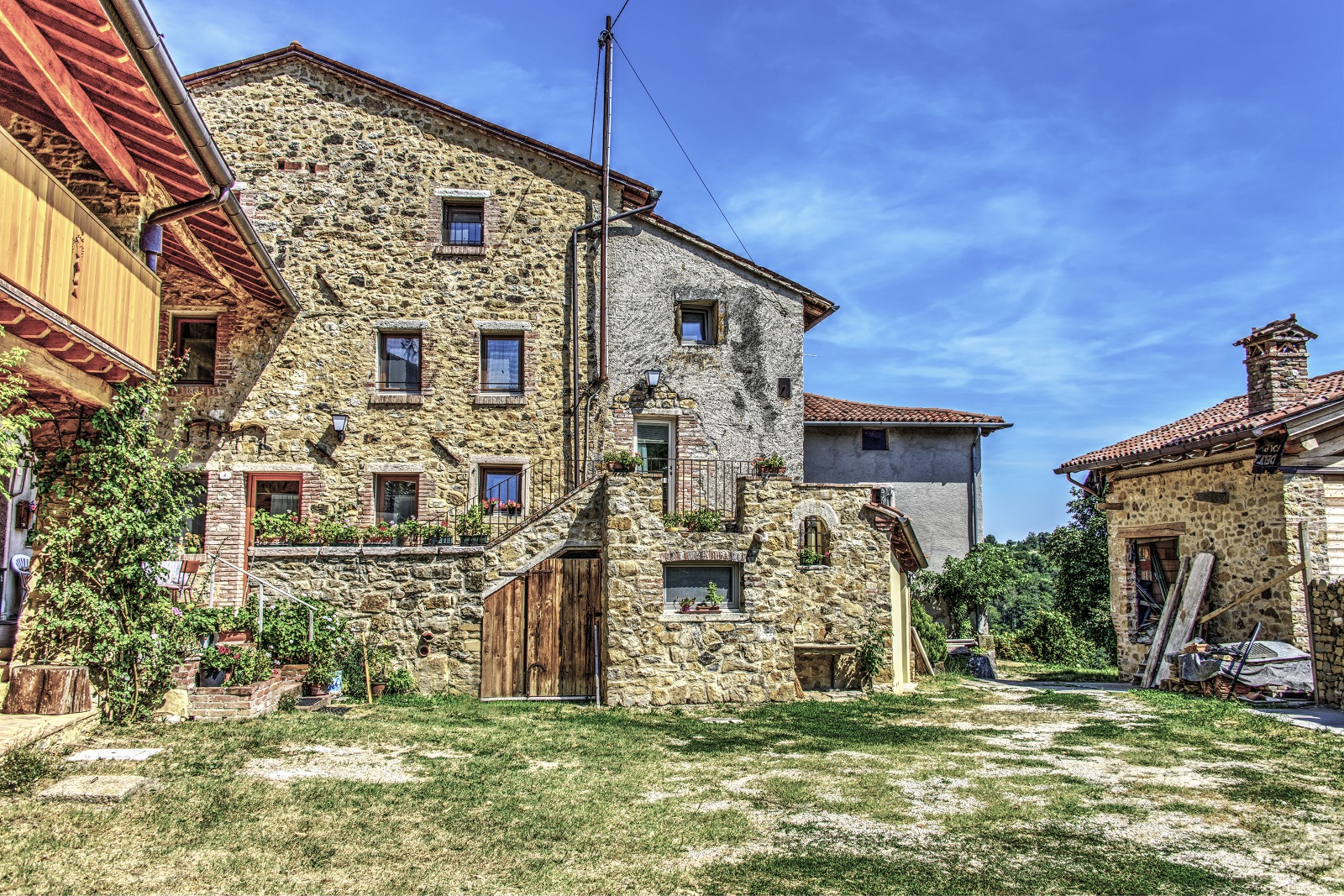
Borgo Castello
Via C.Battisti, 15 - Marostica
Vedi i dettagli -
Da Toi
Via Sisemol, 37 - Marostica
Vedi i dettagli -
Retrò
Via Ravenne, 36 - Marostica
Vedi i dettagli -
Agriturismo Antico Borgo
Via Marosi, 4 - Marostica
Vedi i dettagli -
B&B Maria
Via IV Martiri 21 - Marostica
Vedi i dettagli -
Marostica Bright Apartment
Via Callesello delle Monache 1 -Marostica
Vedi i dettagli -
COLLINE SAN BENEDETTO
Via Canale, 26 - Marostica
Vedi i dettagli -
Al Mulino
Via Gobbe, 60 - Marostica
Vedi i dettagli -
L'Angelo e il Diavolo
Piazza Castello, 41/A - Marostica
Vedi i dettagli -
Inosteria
Via Cassoni, 2 - Marostica
Vedi i dettagli -
Madonnetta
Via Vajenti, 21 - Marostica
Vedi i dettagli -

Lunaelaltro
Corso della Ceramica, 33 - Marostica
Vedi i dettagli -
Scaligera
Via Montello, 68/a - Marostica
Vedi i dettagli -
La Meridiana
Via Perozzi, 9 - Marostica
Vedi i dettagli -
Bistrot 59
Via Sisemol, 59 - Marostica
Vedi i dettagli -
Panic Jazz Club
Piazza Castello, 42 - Marostica
Vedi i dettagli -
Ristorante cinese Oriente
Via G. Cecchin, 20/b - Marostica
Vedi i dettagli -
Da Bastian
Via Gobbe, 10/a - Marostica
Vedi i dettagli -
Da Roberta
Via Panica, 150 - Marostica
Vedi i dettagli -
Da Rossi
Via Consagrollo, 69 - Marostica
Vedi i dettagli -
Caissa
Corso Mazzini, 104 - Marostica
Vedi i dettagli -
Da Bertin
Via Perozzi, 11 - Marostica
Vedi i dettagli -
Da Toi
Via Sisemol, 37- Marostica
Vedi i dettagli -
Da Agnese
Via Pedalto, 23 - Marostica
Vedi i dettagli -
Al Sole
Via Fondati, 3 - Marostica
Vedi i dettagli -
All’Angelo d’Oro
Viale Montegrappa, 20 - Marostica
Vedi i dettagli -
La casetta
Viale Vicenza, 12/A - Marostica
Vedi i dettagli -
Dalla Zita
Via Cà Brusà, 5 - Marostica
Vedi i dettagli -
Ristorante Cuori
Corso Mazzini, 73/75 - Marostica
Vedi i dettagli