To Visit Route 6 - Co’ ‘l fià del tempo: su e zò par le contrà e le masiere de San Florian (With the breath of time: up and down the streets and stone walls of San Floriano)


Starting from the civic center parking lot, head west along the road, passing the school building, and continue toward the Valletta stream. At the bridge, take the right embankment southward until you reach the next bridge. Cross it, switch to the opposite embankment, and head slightly northward into a light woodland until you reach the Val Bella ascent.
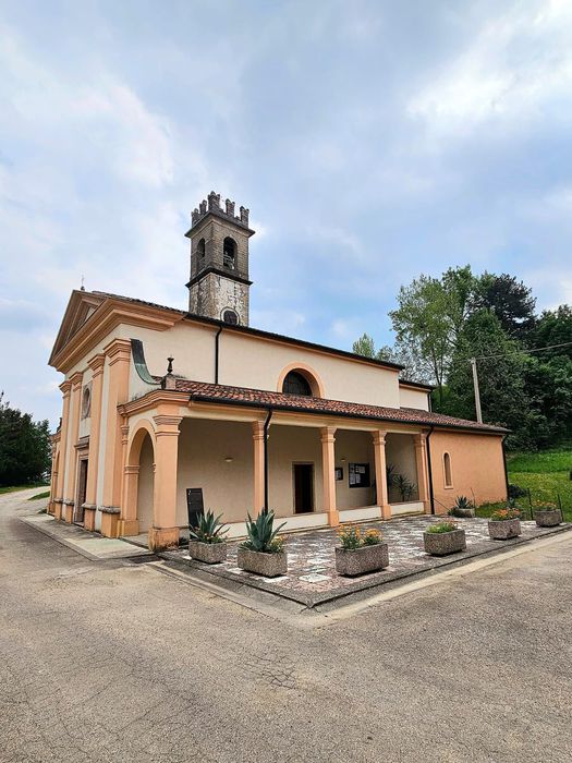
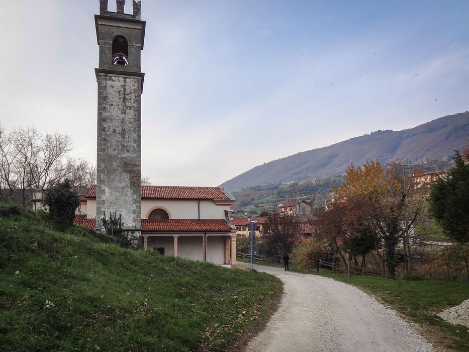
You’ll emerge onto a small dirt road. Turn right here and follow a section of the old Coppolo road, which runs parallel to the current paved road. At the curve, descend toward Contrà Placca, then climb briefly to a baita (mountain hut). From here, turn left, then right, and follow the road to the charming Contrà Capitelli, where you can admire the Santuario dei Capitelli.
From there, descend and briefly overlap with Route No. 3 and the first section of the Seven Route (CAI 800). You’ll arrive near the sports field in Contrà Vallonara. Further ahead, at the old kindergarten, you’ll find the last vertical signpost. Begin a gradual ascent eastward. From this point, only colored ground markings will guide you.
As you descend the hill, stay on the upper path near a metal fence. You’ll reach the last historic hamlet of the loop: Località Costame. From here, descend back toward the town center. To return to the starting point, follow the paved road and the vertical signage, paying close attention and respecting the local road code.
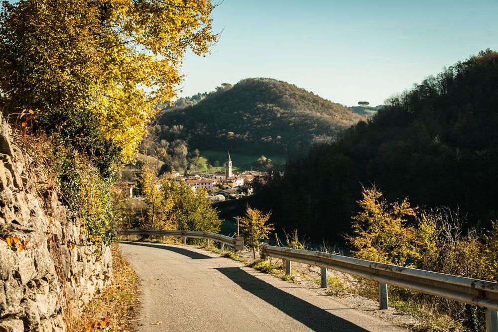
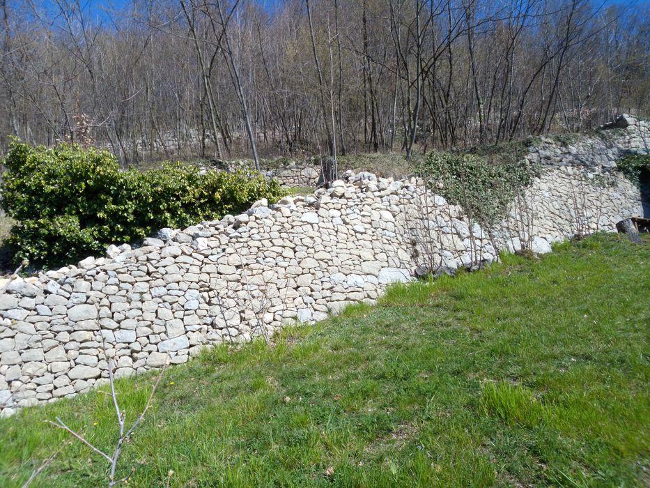
The trail is marked by vertical signposts on poles and horizontal ground markings (white and maroon). We recommend following them closely and staying on the trail to respect the farmland you’ll cross. The route connects a quadrilateral of hamlets: Placca, Capitelli, Vallonara, and Costame. It rediscovers ancient road sections lined with intact dry-stone walls, offering panoramic views and glimpses of untouched rural landscapes.
This is a simple hiking trail, with only minor ups and downs.
Average duration: 1 h 45 min
Length: 6,3 km
Difference in height: 200 mt
Route: Marostica
Accessibility: Paved road - Dirt road - Path
Other routes: Route 3: From the plain to the Asiago Plateau along the transhumance paths
In this route
Accomodation
-
Hotel La Rosina
Contrà Marchetti, 4 - Marostica
Vedi i dettagli -
Fattoria TogoNegro
Via Caribollo, 81 - Marostica
Vedi i dettagli -
A Casa mia
Via Ca' Brusà, 23 - Marostica
Vedi i dettagli -
Agriturismo Antico Borgo
Via Marosi, 4 - Marostica
Vedi i dettagli -
Agriturismo Al Ciliegio
Via Val Bella Alta, 5 - Marostica
Vedi i dettagli -
Agriturismo Ai Marosi
Via Marosi, 2 - Marostica
Vedi i dettagli -
Al Santuario -Ai Capitei
Contrà Capitelli, 7 - Marostica
Vedi i dettagli -
Bistrot 59
Via Sisemol, 59 - Marostica
Vedi i dettagli -
Da Rossi
Via Consagrollo, 69 - Marostica
Vedi i dettagli -
La Rosina
Via Marchetti, 4 - Marostica
Vedi i dettagli -
Da Agnese
Via Pedalto, 23 - Marostica
Vedi i dettagli -
Al ciliegio
Via Val Bella, 5 - Marostica
Vedi i dettagli -
Dalla Zita
Via Cà Brusà, 5 - Marostica
Vedi i dettagli