To Visit Nature trail of San Benedetto
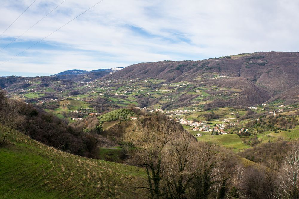
This is the route to enjoy both magnificent views over the nearby landscape, the north with the mountain crown of the pre-Alps, further down the hills above Valle San Floriano, and finally the west with the castles and the city walls in the background.
Average duration: 1 h 30 min
Length: 4 km
Difference in height: Absolute 60 m; Cumulative 169 m
Route: Marostica, Marsan
Other routes: Route 2: From ancient convents to a natural jewel: Gorghi Scuri
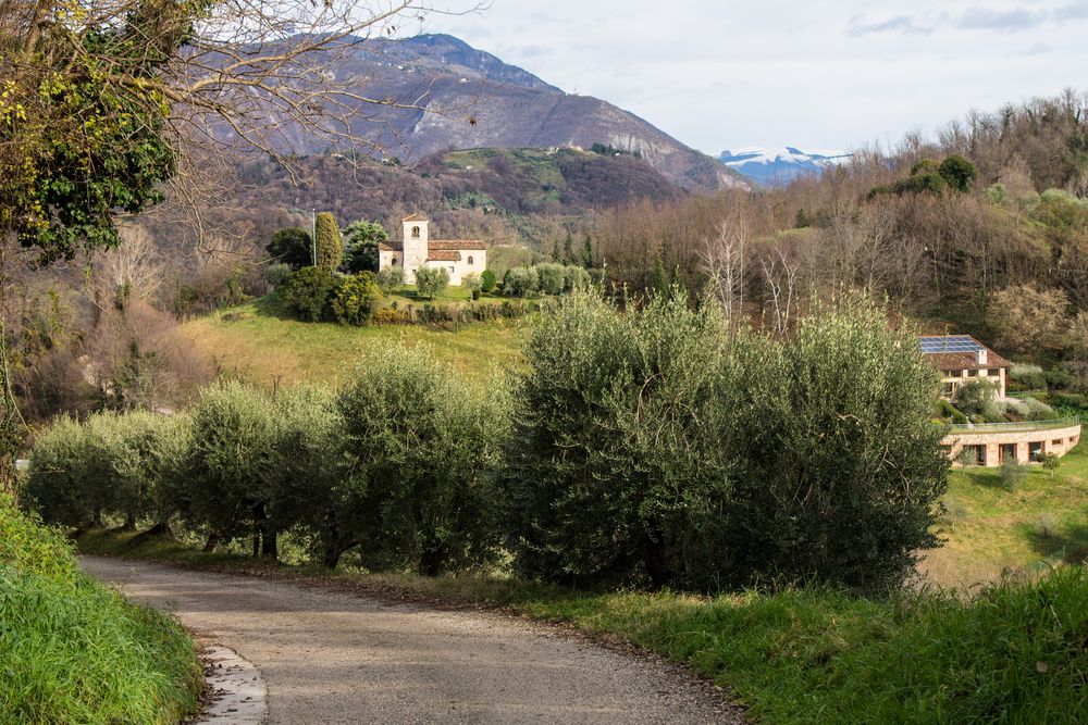
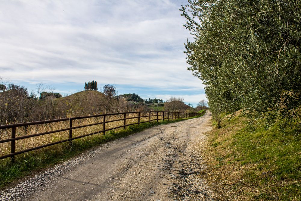
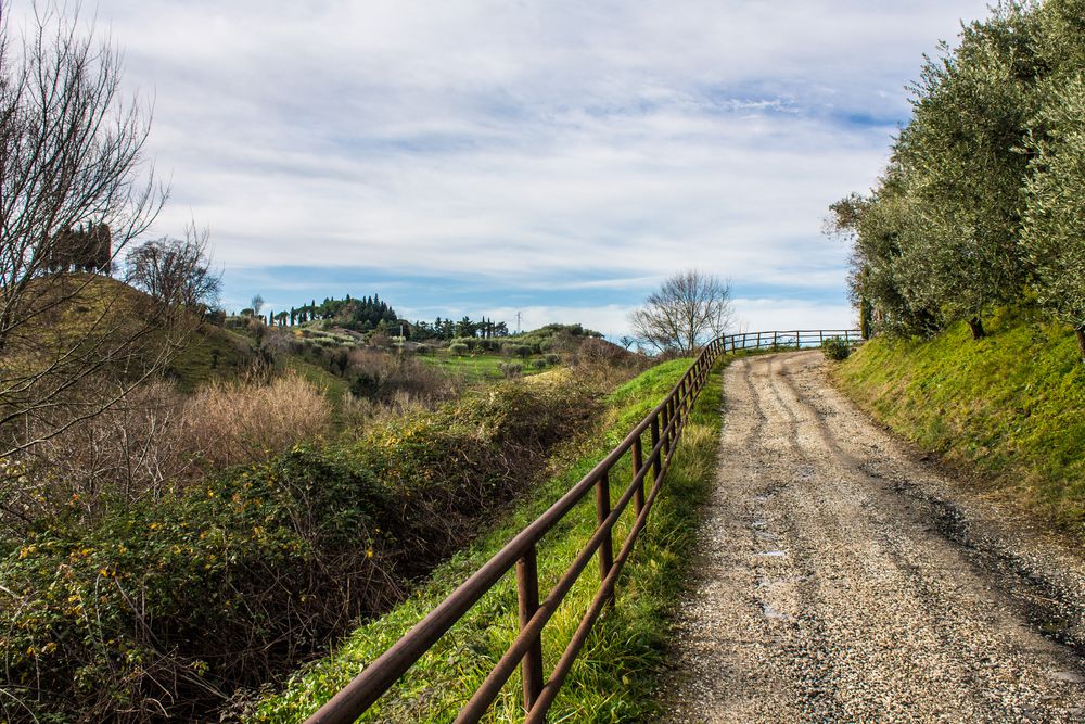
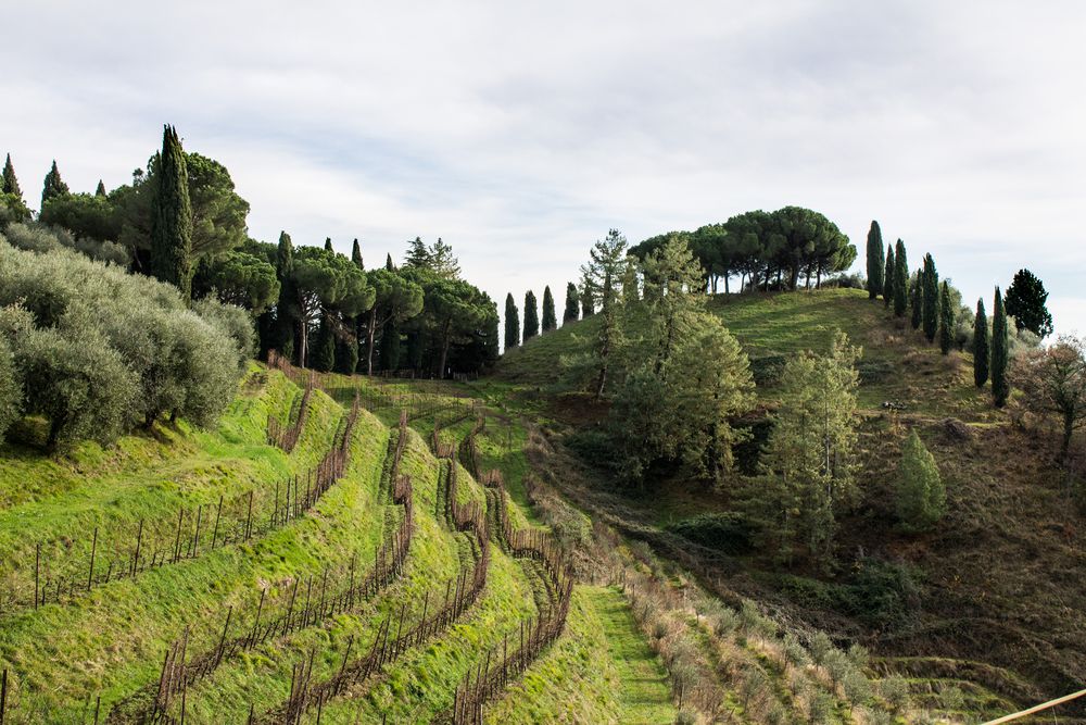
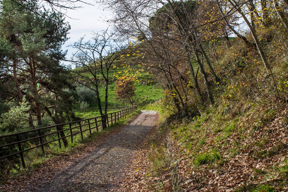
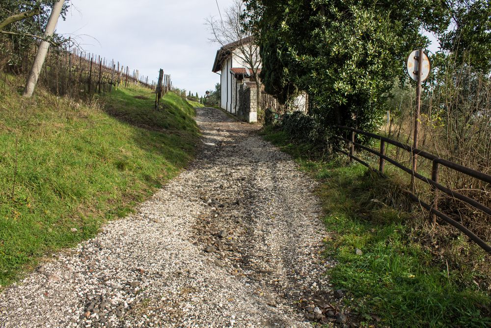
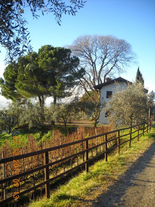
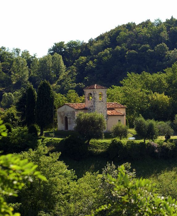
The route starts from the north point of via Sant'Agata in the hamlet of Marsan, opposite the restaurant Sant'Agata where visitors can leave their car. The itinerary starts from here, on an asphalt road and uphill to the north. After a short stretch, a visit can be paid to the little church dedicated to Saints Apollonia and Agata (probably of Lombard origin), which stands on a hilly part north-east of the starting point. Alternatively, follow via Sant'Agata, always on an asphalted road. Some basalt outcrops visible on the way remind of the existence of the Cava Del Monte Gloso quay, which was eventually closed in 2007. The quay used to produce rock of volcanic origin with a dark, almost black, basaltic composition, due to the presence of various minerals (including iron oxides and manganese). The basalt pebbles were used for railway applications, while smaller fragments were used to pave roads and squares. After about 100 meters the road becomes unpaved and goes slightly uphill. A house surrounded by olive trees is located on the right-hand side, while a meadow is visible on the left. Walking further, the road becomes flat and then begins to descend to a crossroads of paths until a rural house on the left. Continue straight on along the unpaved road: the vicinal road of the hills of San Benedetto begins at this point. After an initial mild ascent, the surrounding environment is easier to observe: small hills adorned with cypresses or pine trees, glimpses of tree-lined avenues with cherry trees, groves of oaks, chestnut and birch trees. At the next intersection, near a large building, there is a fountain. A well-kept vineyard is visible from here, which extends in steps on the hillside, below the manor house which occupies the highest position. From the crossroads, continue southwards on a more or less flat path for a few hundred meters until a house with a majestic century-old tree in the front yard: it is a very impressive a European nettle tree (or "stone crusher" as the locals call these trees), which the residents preserve with utmost care. At this point the road becomes a bit bumpy and wheelchaired visitors are required to pay great attention.
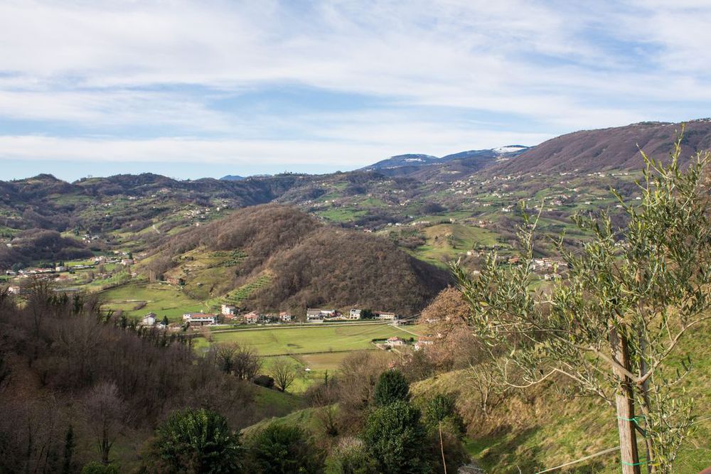
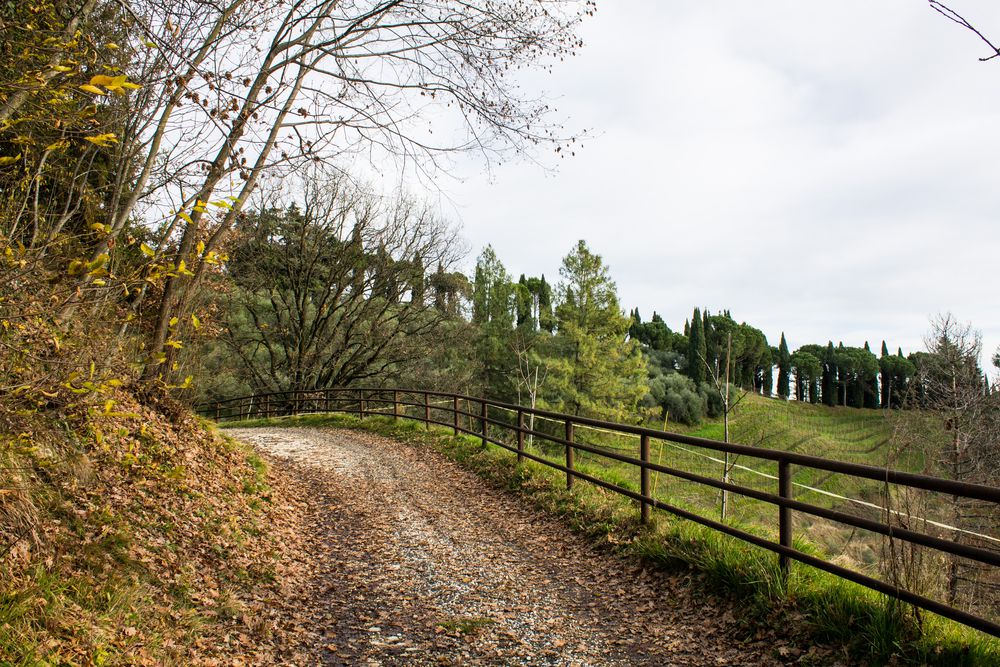
Continuing a little further, you can enjoy other views to the west: the Castello Superiore (Upper Castle) and the adjacent hills until their grafting on the side of the Asiago Plateau, the basins of Vallonara and Valle San Floriano up to the Campana bridge, and the Mount Miesa, which separates the two hamlets of Marostica. This is the stop point of the route and visitors need to go back walking the path backwards as the next stretch of the vicinal road of San Benedetto, which becomes a path, is not practicable. The way back still offers much satisfaction: the landscapes are almost always different from those observed on the outward journey, because of the opposite points of view. Take a chance to more carefully admire the environmental variety, the profiles of the hills, the tree-lined avenues, the woods of pine and fir trees, the valley floor covered with mixed woodland, the views of the plain to the south-east, the Asiago Plateau to the north, and the Mount Grappa at a distance to the northeast.
In this route
Accomodation
-
Hotel La Rosina
Contrà Marchetti, 4 - Marostica
Vedi i dettagli -
Palazzo Sedea
Via Sedea, 14 - Marostica
Vedi i dettagli -
Agriturismo Ca' Tres
Via Nonis, 48 - Marostica
Vedi i dettagli -
Agriturismo Al Filò
Via S. Agata, 1 - Marostica
Vedi i dettagli -
Agriturismo Corte del Maso
Via Sedea, 17 - Marostica
Vedi i dettagli -
COLLINE SAN BENEDETTO
Via Canale, 26 - Marostica
Vedi i dettagli -

Da Pion
Via Scomazzoni, 123 - Marostica
Vedi i dettagli -
Cà Tres
Via Nonis, 48 - Marostica
Vedi i dettagli -
Al Filò
Via S. Agata, 1 - Marostica
Vedi i dettagli -
Brave Wine- Società agricola Srl (ex Diesel Farm)
Via San Benedetto, 2 - Marostica
Vedi i dettagli -

Trattoria Nonna Isetta - Bar Munari
Via Nonis, 1 - Marostica
Vedi i dettagli -
Scaligera
Via Montello, 68/a - Marostica
Vedi i dettagli -
La Rosina
Via Marchetti, 4 - Marostica
Vedi i dettagli -

Sant'Agata
Via S. Agata, 9 - Marostica
Vedi i dettagli -
Casa Bistrot
Via Marsan, 61 - Marostica
Vedi i dettagli